
You are using an out of date browser. It may not display this or other websites correctly.
You should upgrade or use an alternative browser.
You should upgrade or use an alternative browser.
Map of Pre-colonialized Africa
- Thread starter Secure Da Bag
- Start date
More options
Who Replied?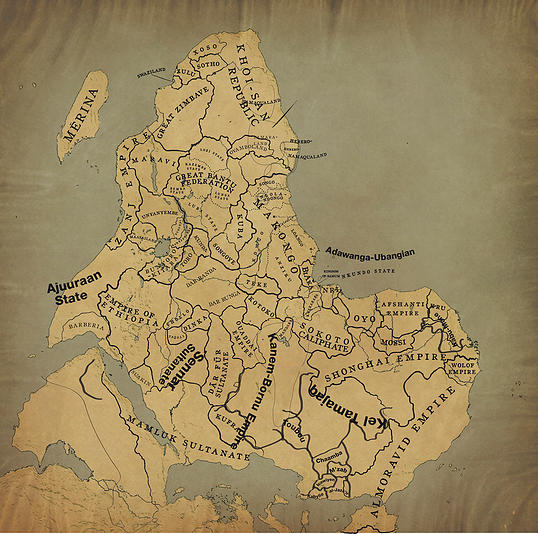

There is no reason for North to be always configured as Up on a planet in space.
Only possible reason is to have Europe on top of a globe map.
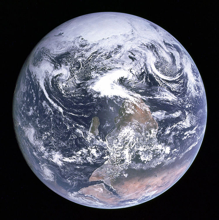
South is up (and Africa on top) in the "Blue Marble" photo -- the famous 1972 photo where Apollo astronauts took a photo of Earth from space
Scientists even admit this:
>>>>"In the true original photograph, the South Pole is on top. For publishing, NASA reversed the image to conform to certain cultural norms.>>>>>>
Only possible reason is to have Europe on top of a globe map.
South is up (and Africa on top) in the "Blue Marble" photo -- the famous 1972 photo where Apollo astronauts took a photo of Earth from space
Scientists even admit this:
>>>>"In the true original photograph, the South Pole is on top. For publishing, NASA reversed the image to conform to certain cultural norms.>>>>>>
Secure Da Bag
Veteran
There is no reason for North to be always configured as Up on a planet in space.
Only possible reason is to have Europe on top of a globe map.
South is up (and Africa on top) in the "Blue Marble" photo -- the famous 1972 photo where Apollo astronauts took a photo of Earth from space
Scientists even admit this:
>>>>"In the true original photograph, the South Pole is on top. For publishing, NASA reversed the image to conform to certain cultural norms.>>>>>>
Link if you got it.
Bboystyle
FIRE MATT LAFLEUR
Swahili P'Bitek
Absorbingpovertywithoutlimitations
Hmm..a bit exagerrated but it's ok. I always wondered how state building would have happened in Africa, but the terrain made it difficult for it to happen before colonization sadly.
Secure Da Bag
Veteran
Hmm..a bit exagerrated but it's ok. I always wondered how state building would have happened in Africa, but the terrain made it difficult for it to happen before colonization sadly.
Well if it's exaggerated, do you have a more accurate map? How did colonization suddenly make the terrain easier for state building?

Swahili P'Bitek
Absorbingpovertywithoutlimitations
Colonies were just pieces of land assigned to European countries, but the method of colonization was by extraction, hence the building of settler economies. There were certain areas that never even saw Europeans because the terrain and climate were too harsh for them to survive and these areas in these ex colonies claim marginalization till this day since they did not get the good nor the bad of colonization, and there is usually free movement of people from these areas from one country to another especially among pastoralist groups.Well if it's exaggerated, do you have a more accurate map? How did colonization suddenly make the terrain easier for state building?
Regarding the map, Take Uganda for instance, which falls under total Bunyoro-kitara occupation, whereas in the region at that time period, there was the expanding Baganda empire,The Toro and Busonga kingdom, the Acholi and Lango pastoralists, The Teso who had their own leader, etc. Making a map of Africa based on former kingdoms is as impossible as making a map of the middle east in 2000BC when empires were rising, falling and borders constantly changing due to the multiple ethnic groups living there at that time, and Africa was like that, times 1000.
Secure Da Bag
Veteran
Related question, but I truly wonder how applicable the relatively new nation state model is in Africa
I'm not for splitting up either, but rather Supranational Unions
I need you to expound on all of that. I see the words but don't understand them.

I need you to expound on all of that. I see the words but don't understand them.
Apologies
 I have a tendency to ramble nonsensically early in the morning
I was just saying that Africa's borders may have to be re-arranged before we can start to see some real nation building, because we all know that many of the borders don't make much sense
But instead of breaking apart into smaller nations, maybe we form larger nations so that we can negotiate fairly with the EU, China, US and so forth. As it stands, most African nations are too small, both in size and in population.
Of course, that comes with it own problems too, but it's just a thought.
TheAnointedOne
Superstar
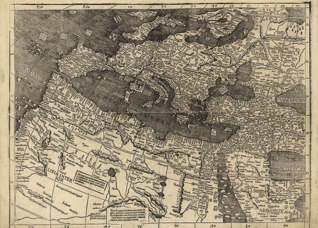
source for the map?
Someone made that map in modern times. Here are some of the oldest known maps. Notice the variations of Ethiopia that is outside of east Africa. To most people outside of Africa, most of it was simply known as Ethiopia.source for the map?
I wish these maps were written in English.
1489 map:

1507 map:

Last edited: